Waitukubuli National Trail
“Discover Nature for Heritage Development”
The Waitukubuli National Trail (WNT) is a first of it’s kind – a long distance hiking trail in the Caribbean – and is located right here in Dominica, the Nature Island!
WNT Segments | Hiking Tips | Fees and Resources | Map & Listings
The Waitukubuli National Trail
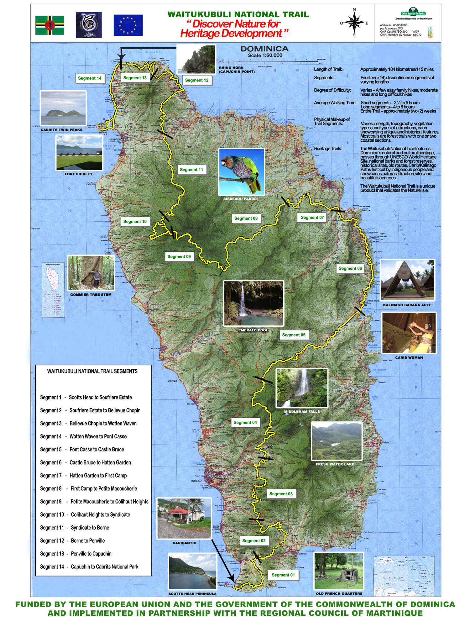
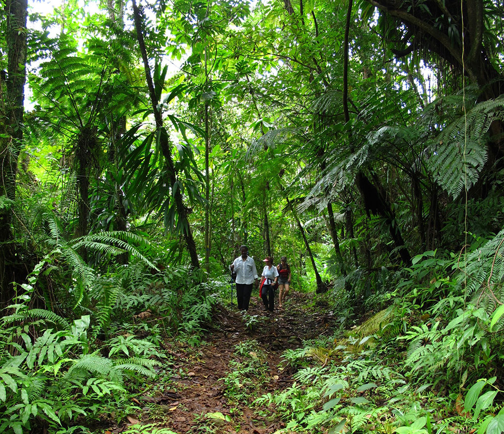
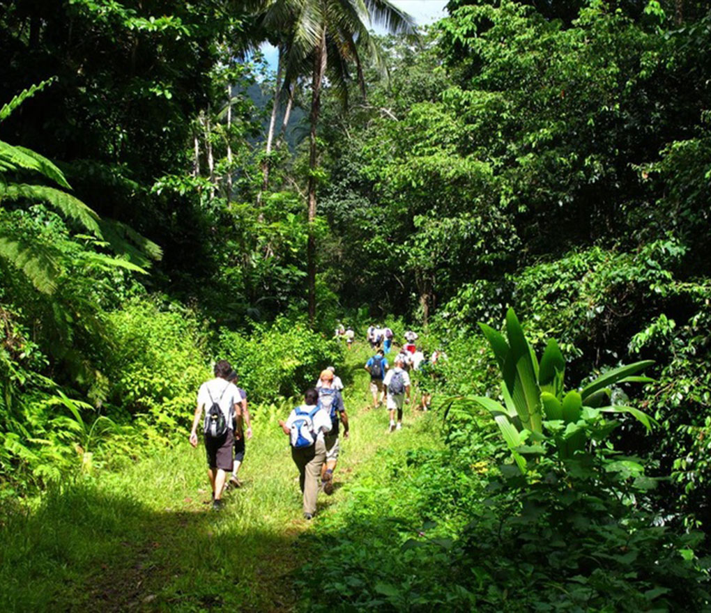
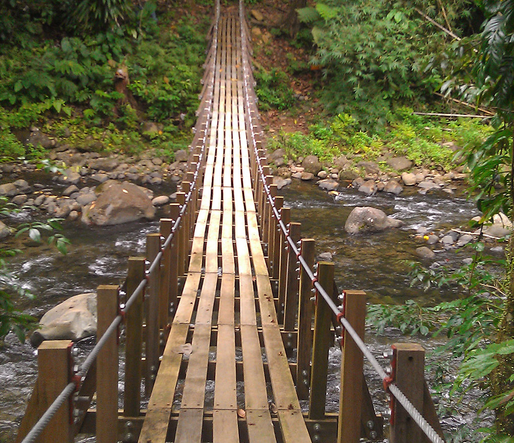
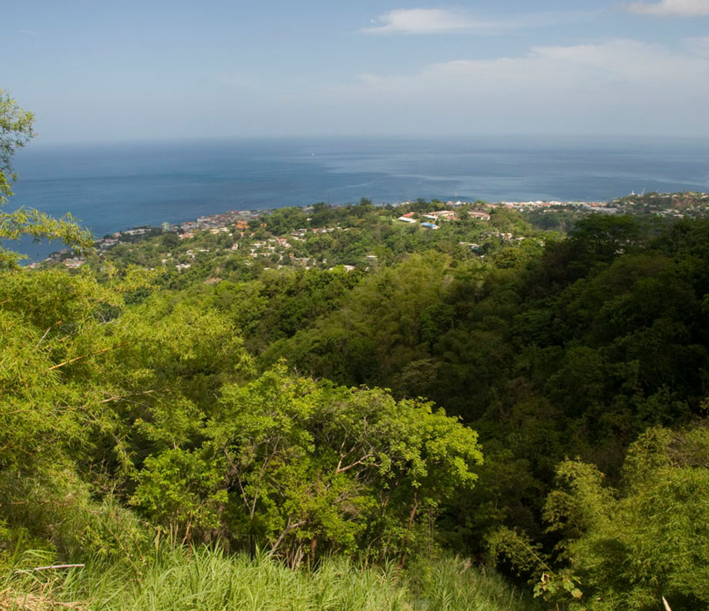
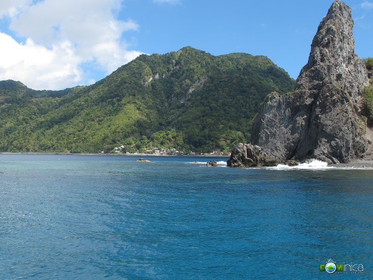
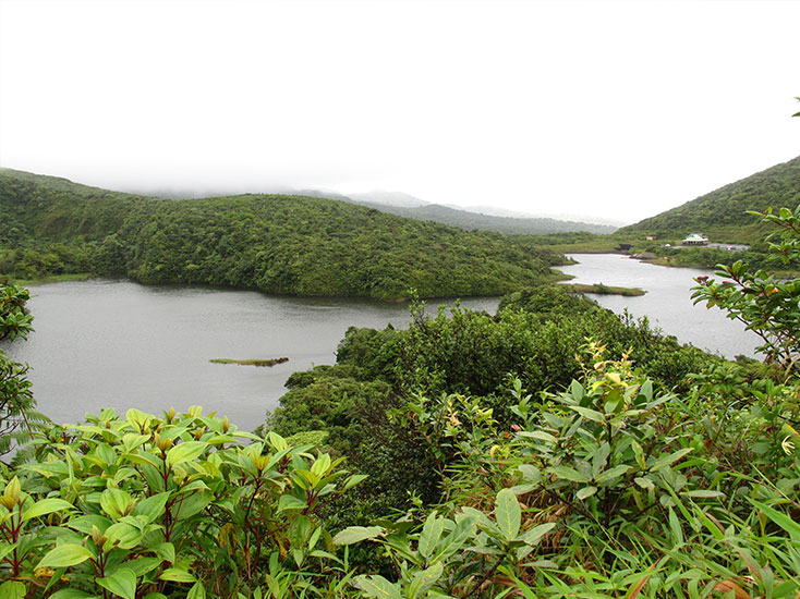
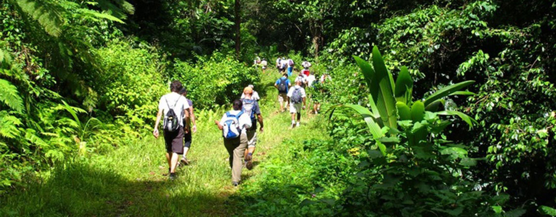
Fondly known as the WNT, the trail covers 114 miles, spanning and twisting the length of Dominica. From Scotts Head in the south to Capuchin in the north, the trail winds from one end of Dominica to the other. Along the way it will take you through coastal villages, up woodland hills, into lush rainforest, past waterfalls, down to rivers, back up to the mountains and then down again to the sea. Dominica’s unique and varied terrain will reveal her age-old secrets to you as you enjoy her natural beauty and vibrant, fresh air. You will also learn about Dominica’s history as you trek across the National Trail. The WNT passes through traditional Kalinago (Carib) villages, ruins of 18th Century French settlements, the renovated Fort Shirley at The Cabrits, the secret ‘Maroon’ passages where runaway slaves escaped and many more interesting historical and natural sites. The WNT was opened in 2011 while work continued. The official Grand Opening Ceremony was held at the Pond Casse Reception Center on May 10th, 2013. The Waitukubuli National Trail’s management falls under Forestry Division and the entire trail has been designated an Eco-Tourist Site. Effective July 1st 2013, all visitors and non-residents must obtain a trail pass (ticket) to access or hike the Waitukubuli National Trail.
For the latest updates on the trail, check out Soufriere Guesthouse’s website
Dominica’s Nature Island Challenge is an annual race much of which takes place on the Waitukubuli National Trail. See here for more video’s and highlights about NIC
Waitukubuli National Trail
Segments of the Waitukubuli National Trail
| Segment | Trail | Distance | Time | Difficulty | Lodging |
|---|---|---|---|---|---|
| 1 | Scotts Head to Soufriere Estate | 7 km / 4.4 miles | 4 – 6 hrs | Easy, Family friendly hike | places to stay |
| 2 | Soufriere Estate to Bellevue Chopin | 11 km / 7 miles | 6 – 6.5 hrs | Moderate hike | places to stay |
| 3 | Bellevue Chopin to Wotten Waven | 14.9 km / 9.3 miles | 5 – 7 hrs | Moderate hike | places to stay |
| 4 | Wotten Waven to Pond Casse | 11.7 km / 7.3 miles | 6 hrs | Moderate hike, Great for Nature Lovers | places to stay |
| 5 | Pond Casse to Castle Bruce | 12.8 km / 8 miles | 7 hrs | Easy, Family friendly hike | places to stay |
| 6 | Castle Bruce to Hatton Garden | 15 km / 9.3 miles | 7 hrs | Moderate hike | places to stay |
| 7 | Hatton Garden to First Camp | 12.6 km / 7.8 miles | 6 hrs | Moderate hike, great for Nature Lovers | places to stay |
| 8 | First Camp to Petite Macoucherie | 10 km / 6.2 miles | 6 hrs | Challenging, best for Strong Hikers who are well trained | Camping only |
| 9 | Petite Macoucherie to Colihaut Heights | 9.8 km / 6 miles | 7 hrs | Hard hike, Great for Nature lovers | places to stay |
| 10 | Colihaut Heights to Syndicate | 6.4 km / 4 miles | 4 hrs | Easy, Family Friendly hike | places to stay |
| 11 | Syndicate to Borne | 10 km / 6.2 miles | 7 hrs | Challenging and long hike, Great for Nature lovers | places to stay |
| 12 | Borne to Penville (Delaford) | 9.5 km / 5.9 miles | 7 hrs | Challenging and long hike | places to stay |
| 13 | Penville to Capuchin | 8 km / 5 miles | 3.5 hrs | Moderate Hike | places to stay |
| 14 | Capuchin to Cabrits National Park | 10.8 km / 6.7 miles | 5 hrs | Moderate Hike **As of Feb 2nd, 2017, see re-route notes above in Intro Section | places to stay |
Hiking Tips
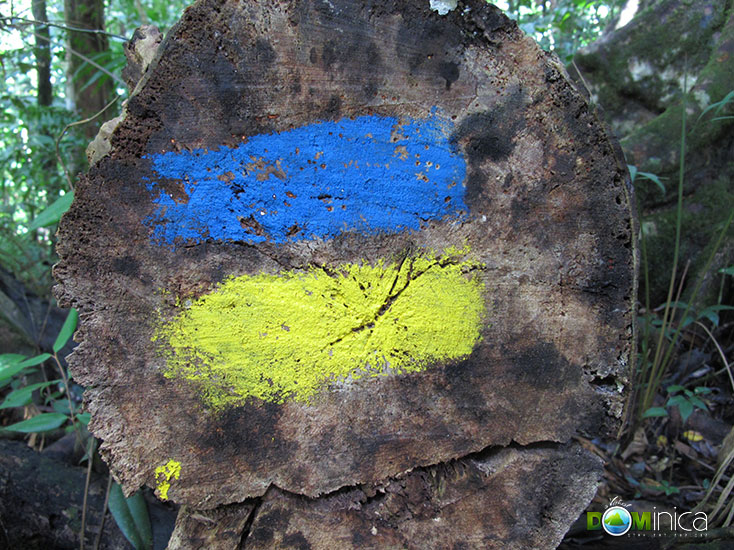
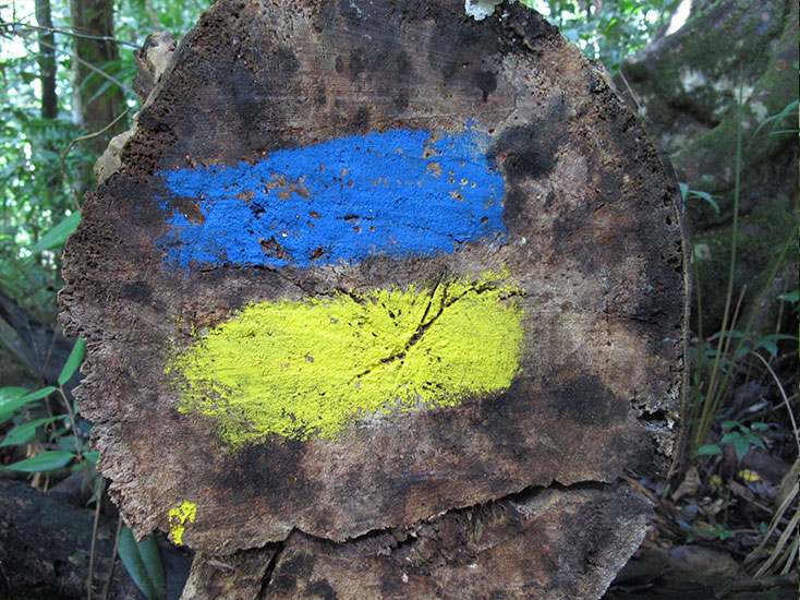 Look for the Blue and Yellow markers!
What to take:
- Water bottle and snacks (consider the distance, time and segment location you will be walking.)
- Wear comfortable clothing (it will be humid)
- Shorts or light pants
- Sneakers with good treads or (waterproof) hiking boots
- Waterproof rain gear (a poncho will also protect camera)
- Camera (width extra film and batteries, and somewhere dry to carry them)
- Insect repellent (but don’t worry, we’ve no poisonous creatures!)
- Sunscreen
- A hat or cap cap
- Swimsuit – you may want to swim along the way!
- Pack some extra clothes – socks, shirt etc to change into
Before the Hike
- Make arrangements to have someone meet you at the other end unless you plan to stay at many of the accommodations available at the end of the segment.
- Let someone know you where you plan to hike, it is best not to hike alone – complete the Hiker Registration form .
On the Hike
- Do not venture off from the trail
- Pack out what you pack in – do not throw litter or waste along the trail
- Respect the plants and wildlife
Watch out for:
- High rainfall can cause flash-flooding of even small streams. Even if it’s sunny, always look to the mountains for heavy cloud cover. For more information see our Weather page
- The dense rainforest can get dark quickly in the late afternoon – especially on eastern slopes
- Hikes often cross rivers – watch out for slippery rocks!
See our Planning Ahead page for more information about how to prepare for a trip to Dominica
Fees and Resources
Trail Passes are categorized as follows:
- Day Pass: To hike one or more segment at a cost of US$12.00 (EC$32.04) and is valid for one day only;
- Special Pass: For pre-sold organised tours and promotional events specifically cruise passengers at a cost of US$10.00 (EC$26.70) and is valid for one (1) day only;
- Fifteen Day Pass: For any of the fourteen (14) segments at a cost of US$40.00 (EC$106.80) and is valid for fifteen (15) days only. Check the Official Waitukubuli National Trail website and Facebook page for recent updates.
Trail Passes are available at the
Waitukubuli Trail Headquarters in Pond Casse and at Forestry and Wildlife Division (Valley Road, Roseau). Passes may also be purchased at various vendors throughout the island, near the trail segments.
Please complete the Hiker Registration form before beginning your trek. More information available on the WNT website, here.
See our list of emergency contact numbers for Dominica
WNT Map and Segment Listings

4 - 6 hours
7 km / 4.4 miles

6 - 6.5 hours
11 km / 7 miles

6 - 7 hours
14.9 km / 9.3 miles

6 hours
11.7 km / 7.3 miles
Waitukubuli National Trail: Segment 05
7 hours
12.8 km / 8 miles
Waitukubuli National Trail: Segment 06
7 Hours
15 km / 9.3 Miles
Waitukubuli National Trail: Segment 07
Segment 7 itself is 6 hours long. However, add Segment 8 (6 hours) to this and the hike time is a total of 12 hours
12.6 km / 7.8 miles
Waitukubuli National Trail: Segment 08
Segment 8 is 6 hours, but add Segment 7 itself this will bring hike time to about 12 hours
Waitukubuli National Trail: Segment 09
6 hours
10 km / 6.2 miles
Waitukubuli National Trail: Segment 10
4 hours
6.4 km / 4 miles
Waitukubuli National Trail: Segment 11
7 hours
10 km / 6.2 miles

7 hours
Difficult - Recommended for strong hikers who are very experienced.
9.5 km / 5.9 miles

3.5 Hours
8 km / 5 miles

5 hours
10.8 km / 6.7 miles
More Things to Do in Dominica


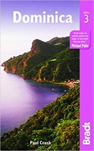
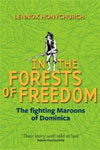
Recommended Reading